Milton,
FL
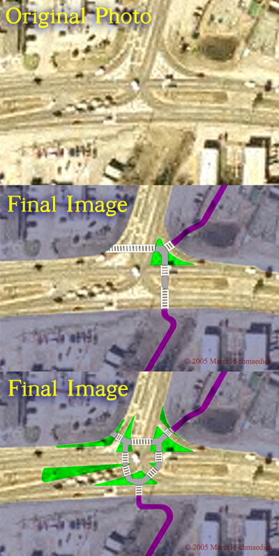
Intersection of
US Hwy 90 and State Route 97; Missing connection
on regional Heritage Trail and Multi-use Path
(Image quality reflects source material)
1st Proposal (less
ambitious)
-add "porkchop" pedestrian crossing island
-add high-visibility croswalk markings
2nd Proposal (more ambitious)
-improved angle of right turn lanes
(motorist slows for turn, is more likely to yield
for pedestrians, and gets better view of approaching
traffic)
-tightened turning radii
-added "porkchop" islands
-extended medians
-shortened pedestrian crossing distances
-added high-visibility crosswalk markings